Handcrafted LED aviation sectional maps that display real-time METAR flight conditions — green, blue, red, magenta — for every reporting airport on your wall. Built to order, by a pilot.
The technology
Every AeroGlow map connects to the FAA's aviation weather network and updates its LEDs automatically. No app. No fuss. Just glance at the wall.
Your map pulls live METAR reports directly from aviationweather.gov over your home WiFi. Every reporting airport in your chosen region is covered.
Each LED sits precisely behind an airport on a high-quality printed sectional chart. The ESP32 controller maps real conditions to each light individually.
Green for VFR, blue for MVFR, red for IFR, magenta for LIFR. High winds fade to orange. Thunderstorms flash like real lightning. At a glance you know exactly what the weather is doing.
Connect to WiFi once through a simple setup page. After that, it runs itself — day and night.
Flight categories
Gallery
Every AeroGlow is built by hand — drilled, wired, and tested. Your map arrives ready to hang.
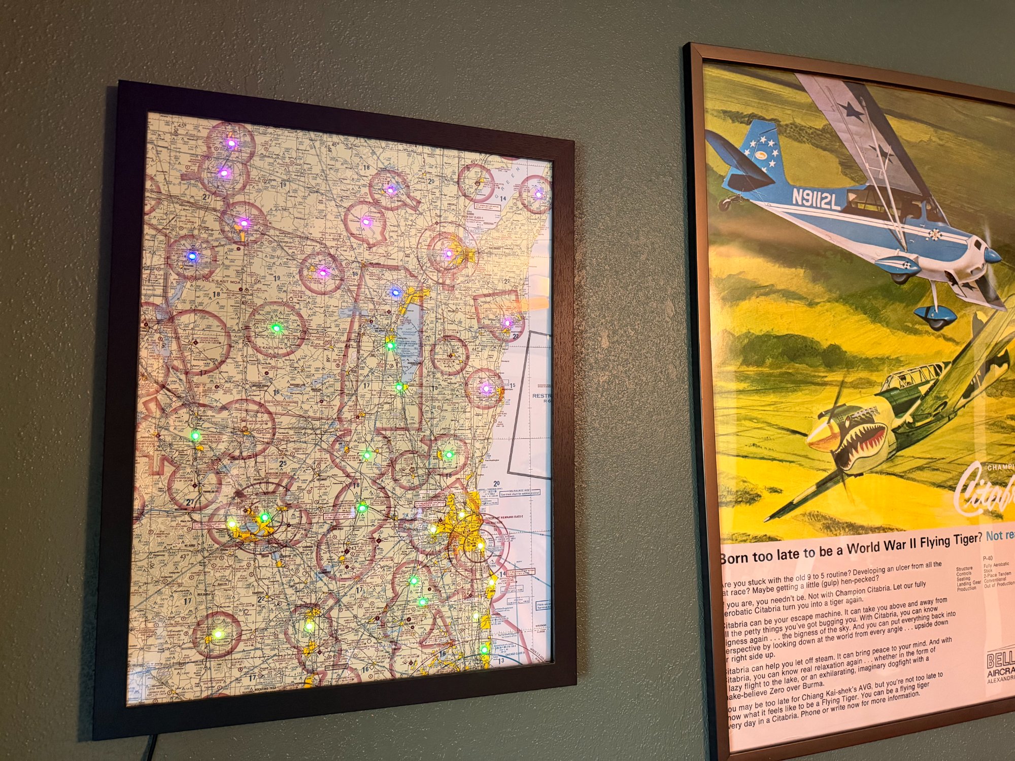
Your map
here soon
Your map
here soon
📸 Photos coming as new maps are built. Be among the first.
Why AeroGlow
Every AeroGlow map is assembled by hand in Wisconsin by a working network engineer and flight instructor. That means the wiring is clean, the firmware is custom, and you can actually talk to the person who built your map.
Because these are made to order, you choose your region, your frame style, your LED density, and your mounting preference. If you want something unusual — your home airport centered, a non-standard region, a custom frame material — just ask.
Start your order →I built the first one for my own wall. I wanted to glance up before heading to the airport and know — without opening an app — what the weather was doing across my airspace. That's still exactly what this is.
Runs on a custom ESP32-based board with individually addressable WS2812B LEDs. The firmware is purpose-built for this application — clean, reliable, and actively maintained.
Want your local sectional? A multi-sectional corridor? The upper Midwest? Tell me what airspace matters to you.
WiFi trouble? Questions about your map? Just reach out. There's no ticket system or call center — just a real person who built your map and wants it working right.
Made to order
Fill out a short inquiry and I'll get back to you within 48 hours with options, pricing, and lead time. No commitment required.
Commission Your Map